Unveiling forests from a satellite and drone perspective on International Day of Forests
For the International Day of Forests, the FORWARDS project unveils a transformative approach to monitoring forests, thanks to advanced satellite imagery.
21 March 2024 – The project seeks to redefine our understanding and stewardship of forest ecosystems and draws on a consortium including the Swiss Federal Institute of Forest, Snow and Landscape Research (WSL) and the University of Florence (UNIFI), Italy.
Navigating new perspectives through satellite and drone imagery
FORWARDS endeavours to revolutionise how we perceive forests by providing unprecedented insights through satellites and drones imagery. It aspires to show the intricate tapestry of these ecosystems from a vantage point that was once beyond our reach. This shift in perspective is poised to deepen our appreciation for the complexities of forest dynamics and to foster a heightened sense of environmental awareness. By harnessing the precision and depth of satellite data, FORWARDS aims to set a new standard for environmental stewardship, facilitating more nuanced and informed decision-making in the management of forests.
Celebrating collaborative expertise
The collective expertise of project partners WSL and UNIFI becomes instrumental in using satellite and drone data for sophisticated forest monitoring. They can thus significantly contribute to a better understanding of forests and to optimal conservation strategies.
Advancing Forest Monitoring within FORWARDS
The project pioneers methodologies that combine satellite and drone data with ground-based observations. This is not only to observe forests but also to decipher patterns, detect anomalies, and map disturbances.
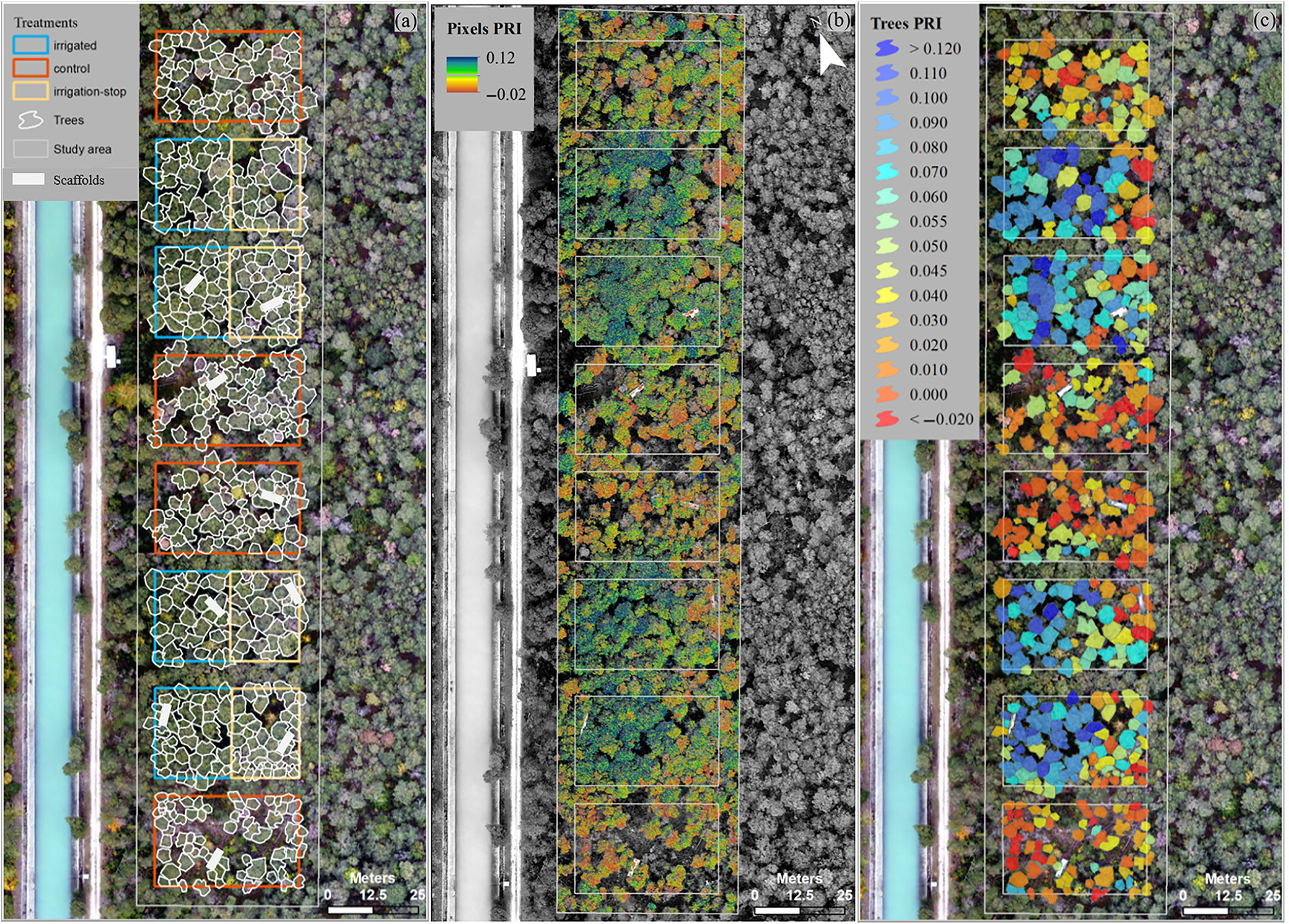
WSL offers a compelling example drawn from an experimental irrigation site in Valais, Switzerland. The project meticulously analyses the different treatments with varying soil water availability, utilising drone-captured RGB HD-images combined with multispectral sensor data, , and advanced techniques such as the photochemical reflectance index (PRI). This innovative approach serves as a pre-visual stress assessment, enabling the detection of potential issues before they manifest visibly.
The left image below shows an aerial view of the Pfynwald irrigation site in Valais, Switzerland, with >100-year-old Scots pine trees. Red borders indicate untreated plots, blue borders show areas irrigated since 2003, and yellow borders represent irrigation-stop treatment where irrigation was halted after 10 years.
The centre image displays a normalised difference index (PRI) per pixel, which is on the right image averaged over each tree crown. The colour code indicates drought stress (red trees) and sufficient water (blue trees). Drone imagery and PRI, validated with additional direct measurements in the canopy from scaffolds, enable early detection of drought stress.
This drone-based stress assessment, detailed in the CC-BY-NC licensed article by D’Odorico et al. (2021), allows scalable, high-resolution monitoring of tree health and responses, as well as long-term acclimation to drought stress.
The University of Florence complements these efforts with a focus on mapping forest disturbances. Leveraging active and passive remotely sensed data from satellites and UAV platforms, the project conducts in-depth analyses to identify causes, understand effects on ecosystem functioning, and assess overall ecosystem vulnerability. The integration of artificial intelligence mapping agents further increases the efficiency and accuracy of the assessment process.
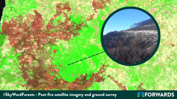
For example, satellite imagery from Copernicus Sentinel-2 satellites, processed by the University of Florence, unveils the extent of damage inflicted by a wildfire in a forest in Calabria, Italy, as shown in the image below:
Forest clearcutting is another occurrence that can be identified through satellite imagery: below is a comparison between 2022 and 2023 of the same coppice forest in the south of Tuscany, Italy, taken from a satellite and automatically mapped through artificial intelligence. The mapping is then confirmed by the on-site survey.
![]()
Drawing on advanced technologies, techniques and partnerships, FORWARDS envisions a future in which satellite data becomes indispensable for enhanced forest monitoring. This, in turn, will significantly help manage – and conserve – these vital ecosystems.
Citation:
- D’Odorico, P., Schönbeck, L., Vitali, V., Meusburger, K., Schaub, M., Ginzler, C., Zweifel, R., Velasco, V. M. E., Gisler, J., Gessler, A., & Ensminger, I. (2021). Drone-based physiological index reveals long-term acclimation and drought stress responses in trees. Plant, Cell & Environment, 44(11), 3552–3570. DOI: 10.1111/pce.14177
- Francini, S., & Chirici, G. (2022). A Sentinel-2 derived dataset of forest disturbances occurred in Italy between 2017 and 2020. Data in Brief, 42. https://doi.org/10.1016/j.dib.2022.108297
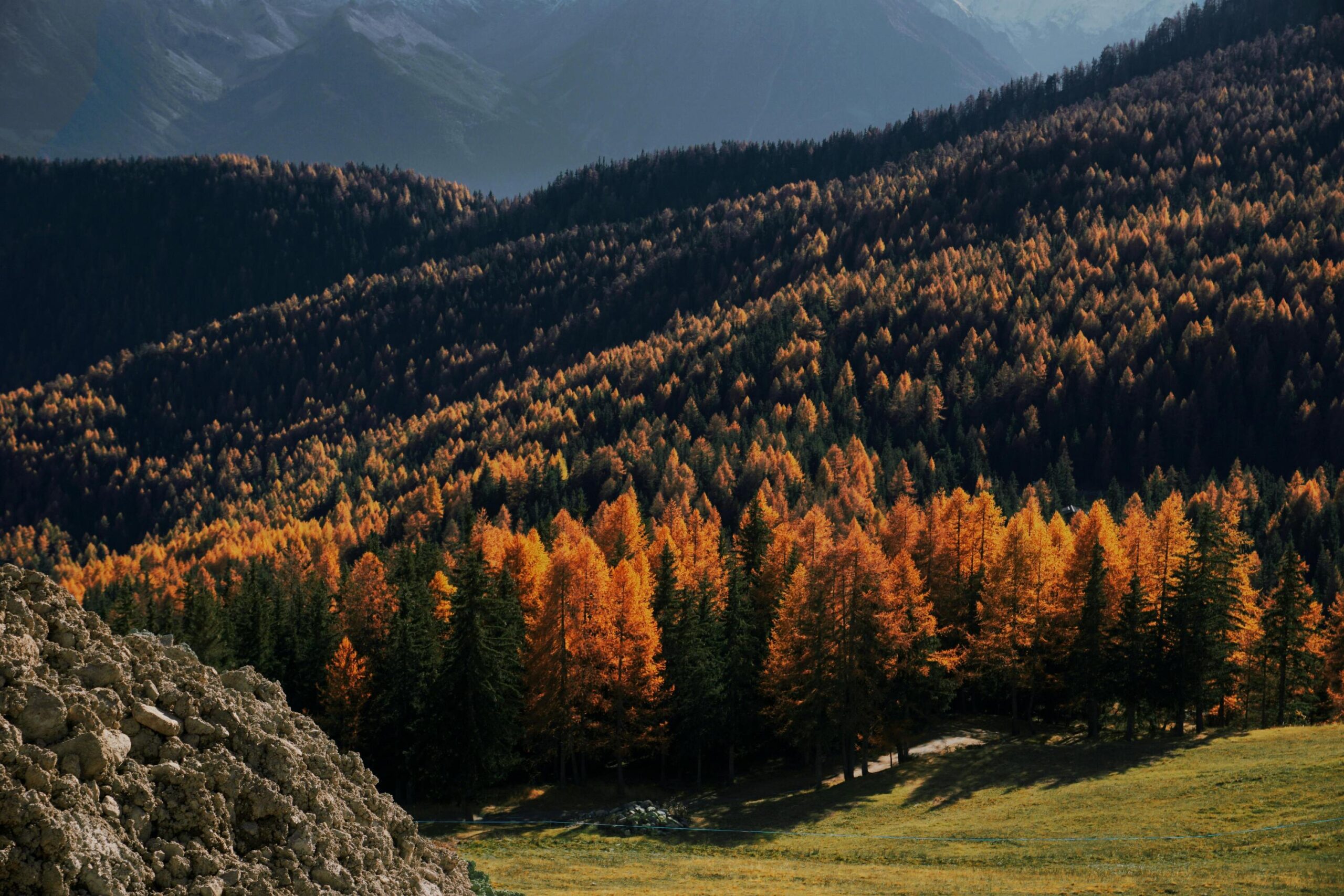
Cover image by Anna Travaglione on Pexels.